Geographic Information System
Interactive Map

December 2021 Sewer Maintenance Map
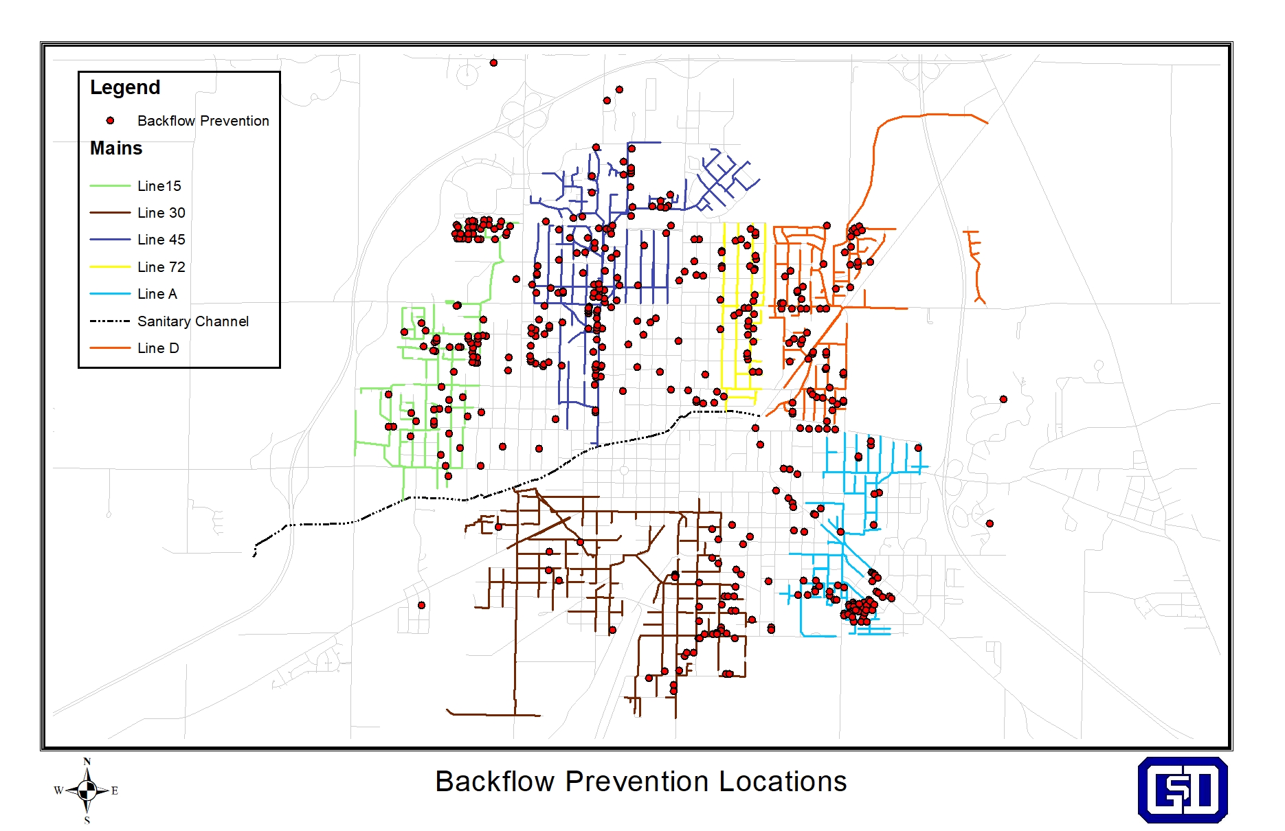
Location of all residental backflow prevention installations.
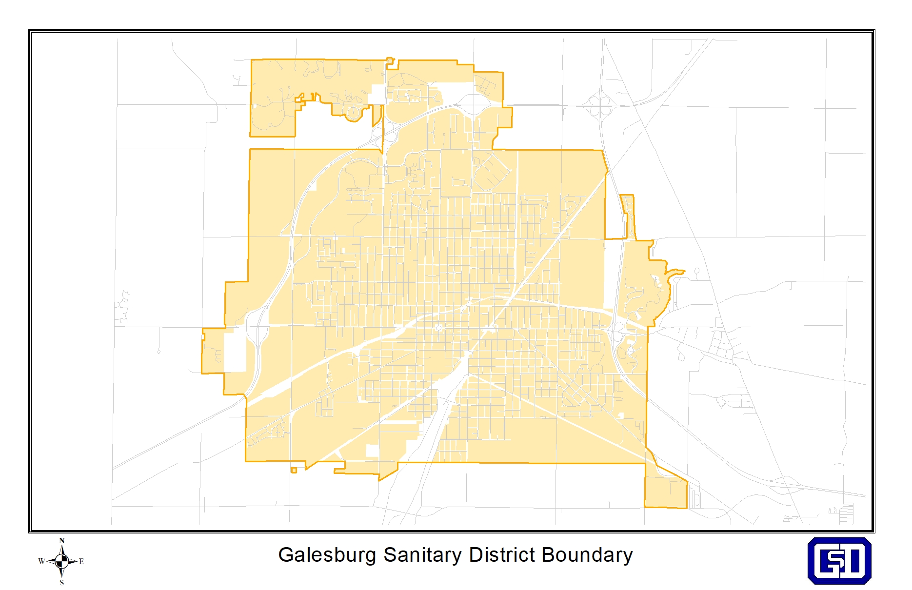
Galesburg Sanitary District Annexed parcels and Boundary.
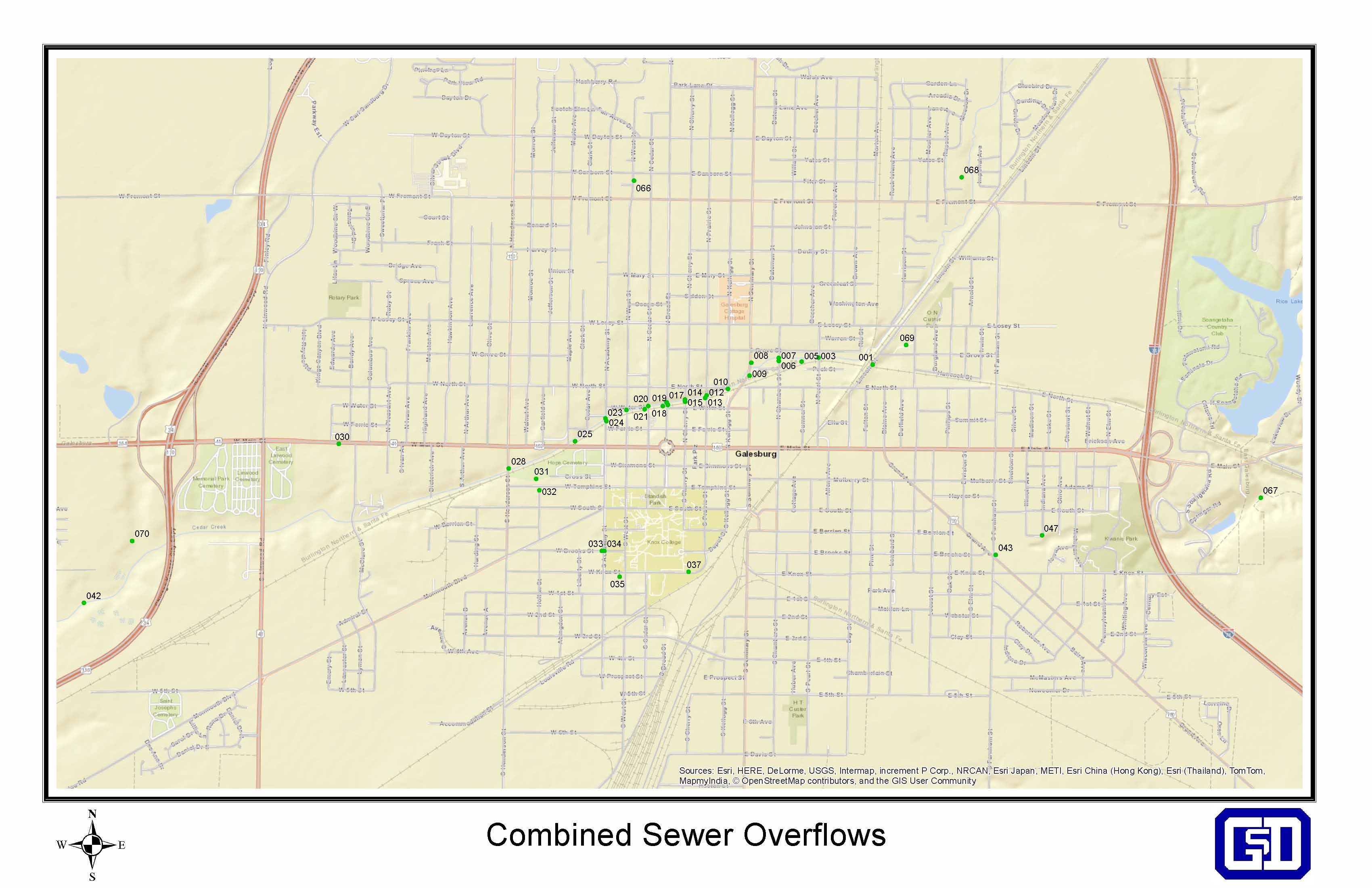
Combined Sewer Overflow Location Map
What Is GIS?
GIS (Geographic Information Systems) is computer mapping system designed to capture, store, manipulate, analyze, manage, and present all types of Geographical data. GIS helps you answer questions and solve problems by looking at your data visually in a way that is quickly understood and easily shared. Furthermore, GIS technology combines common database operations with unique visualization to allow for fast and efficient data query, analysis and management.
More About Geographic Information Systems
Department History
The Galesburg Sanitary District began it’s GIS project in 2000 and has steadily and consistently grown its inventory of data and information since then. Before implementing GIS, most information could be found on as-built construction plans, many of which date back to the 1920’s and 1930’s. Overtime, the system was built from these construction plans as well as the use of aerial photos and GPS. More recently, many of these plans have been digitally scanned and “attached” with application program interface (API) software allowing district personnel to find and view all information, both in office and in the field, in a matter of seconds saving crucial time.
Function
The GIS Department is responsible for management, maintenance and improvements of geographic data layers for all sanitary sewers and approximately 2/3 of the storm sewers within the city of Galesburg, Il. GIS helps increase the efficiency, reduce costs, improve coordination, and deliver precision and accountability throughout all departments within the District.
Disclaimer
Every effort has been made to ensure the accuracy, correctness and timeliness of the materials presented. The Galesburg Sanitary District assumes no liability for damages incurred directly or indirectly as a result of incomplete, incorrect or omitted information, even if the District has advised of the possibility that the information may not be accurate. The user of this information assumes all liability for their dependence on this information and assumes responsibility for the information. Areas depicted by these digital products are approximate, and are not necessarily accurate to mapping, surveying, or engineering standards. Detailed questions should be directed to the Galesburg Sanitary District GIS Administrator, at (309) 342-0131.
Message Us
Galesburg Sanitary District
2700 West Main St
Galesburg Il, 61401
Phone: (309)-342-0131
Fax: (309)-342-2842